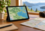
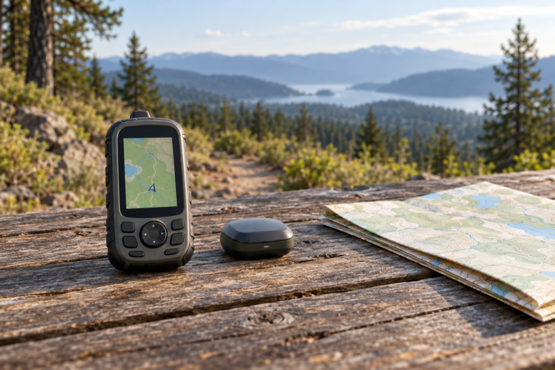

Choose the Garmin GPSMAP 67 if detailed trail maps are your priority, or the eTrex SE for simpler waypoint navigation with replaceable AA batteries. For covered U.S. coastal waters, consider the GPSMAP 79sc. If you want GPS data for an existing tablet, the Dual XGPS160 is a different kind of purchase: an external Bluetooth receiver that needs a compatible device and app.
These picks compare manufacturer-documented features and the jobs each product can do. We have not field-tested their reception, accuracy or battery life. Decide first whether you need a self-contained navigator with a screen or a receiver that supplies location to another device.
Compare the four options
| Receiver | Choose it for | Map or app arrangement | Power and main connection |
|---|---|---|---|
| Garmin eTrex SE | Basic hiking and waypoint navigation | Monochrome display; cities-only basemap | Two AA batteries, sold separately; USB-C |
| Garmin GPSMAP 67 | Trail navigation with detailed maps | Preloaded TopoActive U.S., Mexico and Canada | Internal rechargeable battery; USB-C |
| Garmin GPSMAP 79sc | Covered U.S. coastal waters and Great Lakes | Preloaded BlueChart g3 coastal charts | Two AA batteries, sold separately; micro-USB |
| Dual XGPS160 | Adding location to a compatible tablet/app | Separate device and navigation app required | Rechargeable battery; Bluetooth location connection; USB charging |
1. Garmin eTrex SE: for basic navigation with AA power
The eTrex SE makes sense when you mainly want to follow a course, save locations and check your direction. Garmin specifies a 2.2-inch monochrome display and a cities-only basemap. That is an important limit: choose the GPSMAP 67 instead if you want detailed topographic maps on the handheld itself.
The SE uses two AA batteries, which are sold separately, and has USB-C for its computer connection. Its official product information also describes Bluetooth-connected Garmin Explore features. The computer manual notes that a Mac does not detect the device by default and directs users to Garmin Express for file access. Check that workflow before buying it for a particular computer.
The selected listing is one eTrex SE, part 010-02734-00, with documentation. It is not the eTrex Solar or eTrex Touch. Add suitable AA batteries to your budget, and check the model when comparing retailer bundles.

Garmin eTrex SE 010-02734-00, one handheld
As an Amazon Associate we earn from qualifying purchases.
2. Garmin GPSMAP 67: for detailed trail maps
The GPSMAP 67 offers a 3-inch color display, multi-band GNSS, a barometric altimeter and a three-axis compass. The selected U.S. model includes TopoActive maps for the U.S., Mexico and Canada. We would choose it over the eTrex SE when seeing the surrounding terrain on the device matters more than keeping the map display simple.
Its internal battery recharges rather than taking replacement AAs, and its interface is USB-C. Satellite imagery downloads use Wi-Fi; additional premium map layers are available through an Outdoor Maps+ subscription. Decide which maps you need before adding paid services. The GPSMAP 67 manual also directs Mac users to Garmin Express for file access.
Check for GPSMAP 67, part 010-02813-00. This is the version without built-in inReach satellite communication. Do not buy it expecting the messaging or SOS features associated with a different inReach-equipped model. Confirm the seller’s exact box contents rather than treating every 67-series bundle as identical.
3. Garmin GPSMAP 79sc: for a floating marine handheld
The GPSMAP 79sc is the marine choice here because Garmin documents a floating design, a 3-inch color display and preloaded BlueChart g3 coastal charts. The selected 010-02635-02 version covers the U.S. and Great Lakes. Verify your actual cruising area and chart requirements before ordering.
Pay attention to the final letters: Garmin’s shared specifications identify preloaded detailed mapping as an sc-version feature. The 79s is a different map configuration. Both the map coverage and the supplied accessories need checking when comparing regional models or retailer bundles.
This model uses two separately purchased AAs and micro-USB. Its manual documents NMEA 0183 input/output and a Garmin Spanner mode for a virtual serial connection with compatible mapping software. Those interface options do not promise that every computer, marine display or navigation program can use it; confirm the software, cable and data format for your intended connection.
4. Dual XGPS160: for a tablet that needs external GPS data
The XGPS160 SkyPro supplies location over Bluetooth instead of giving you a standalone map screen. Dual specifies GPS and GLONASS reception, up to ten position updates per second and connections to as many as five Apple or Android devices. Update frequency describes how often positions are supplied; it is not a measured accuracy ranking.
For Android, the current SkyPro GPS Status Tool includes the helper function and must run in the background; its instructions require mock-location setup. For Apple devices, the SkyPro utility is optional, with its current compatibility field requiring iOS or iPadOS 12.0 or later. Your navigation app has its own requirements. Verify installation and external-receiver support on your exact device before buying.
The receiver does not supply internet access or a complete set of navigation maps. Choose an app with the offline maps you need, or arrange its required data connection. Dual lists NMEA and Apple protocols and USB charging; its current maker package lists a USB-C charging cable. Confirm the connector on the unit supplied, especially with third-party stock, and do not assume a charging cable provides a supported USB GPS-data connection.
Choose the whole navigation setup
Start with the map: a cities-only basemap, topographic mapping, coastal charts and a phone app solve different problems. Check geographic coverage, offline access and any paid map layers. GPS reception alone does not establish that the device has the detailed map you need.
Then plan power and connections. The eTrex SE and 79sc need AAs; the GPSMAP 67 and XGPS160 have rechargeable batteries. For an external receiver, budget for the host device and app as well, and verify that the app accepts its location feed. We would test the complete setup near home before depending on it on a trip.
Frequently asked questions
Is an external Bluetooth receiver the same as a handheld GPS?
No. The Garmin choices here have their own screens and navigation functions. The XGPS160 supplies location to a separate compatible device and app, so the app and its maps are part of the purchase decision.
Does the eTrex SE include detailed trail maps?
Garmin describes its basemap as cities only. Choose a model with the required detailed mapping, such as the selected GPSMAP 67 with TopoActive maps, if you want to examine trail terrain on the handheld itself.
Is GPSMAP 67 the same as GPSMAP 67i?
No. The selected GPSMAP 67 part is configured without built-in inReach. Check the exact model and required service before buying any device for satellite communication or SOS.
Will the XGPS160 work with every iPad or Android app?
Do not assume so. Check the current app listing, your device’s operating system and the navigation app’s external-GPS support. Android also needs the documented helper/mock-location arrangement. A receiver connection does not supply offline maps or remove an app’s network requirements.
Can I use the same charging and data cables for all four?
The Garmin eTrex SE and GPSMAP 67 specify USB-C, while the 79sc specifies micro-USB. Confirm the supplied XGPS160 revision and charging cable separately. Matching a connector is only the first check; the device’s supported data protocol and your software must also match.